NewFor residential agents
Your AI agent finds likely-to-sell owners, and contacts them for you.
Lot Atlas analyzes new signals daily, identifies best prospects,
and runs multi-channel outreach.
You're in. We'll email your invite as soon as early access opens.
Read 1,499 recorded deeds and 96 new probate filings across Maricopa County.
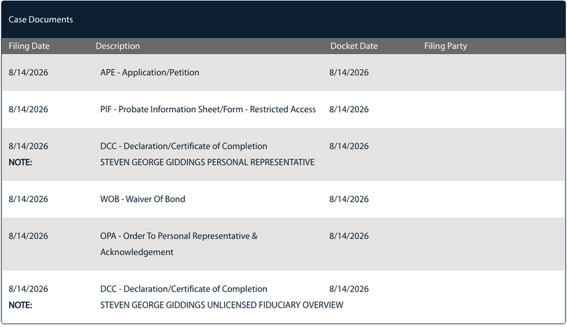
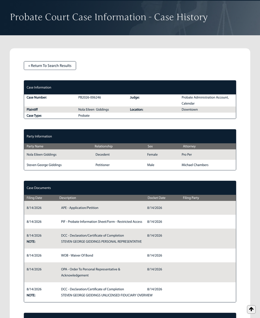
Flagged 11208 W Cameo Dr, Sun City: probate opened, the owner was the only name on title.
PB2026-0451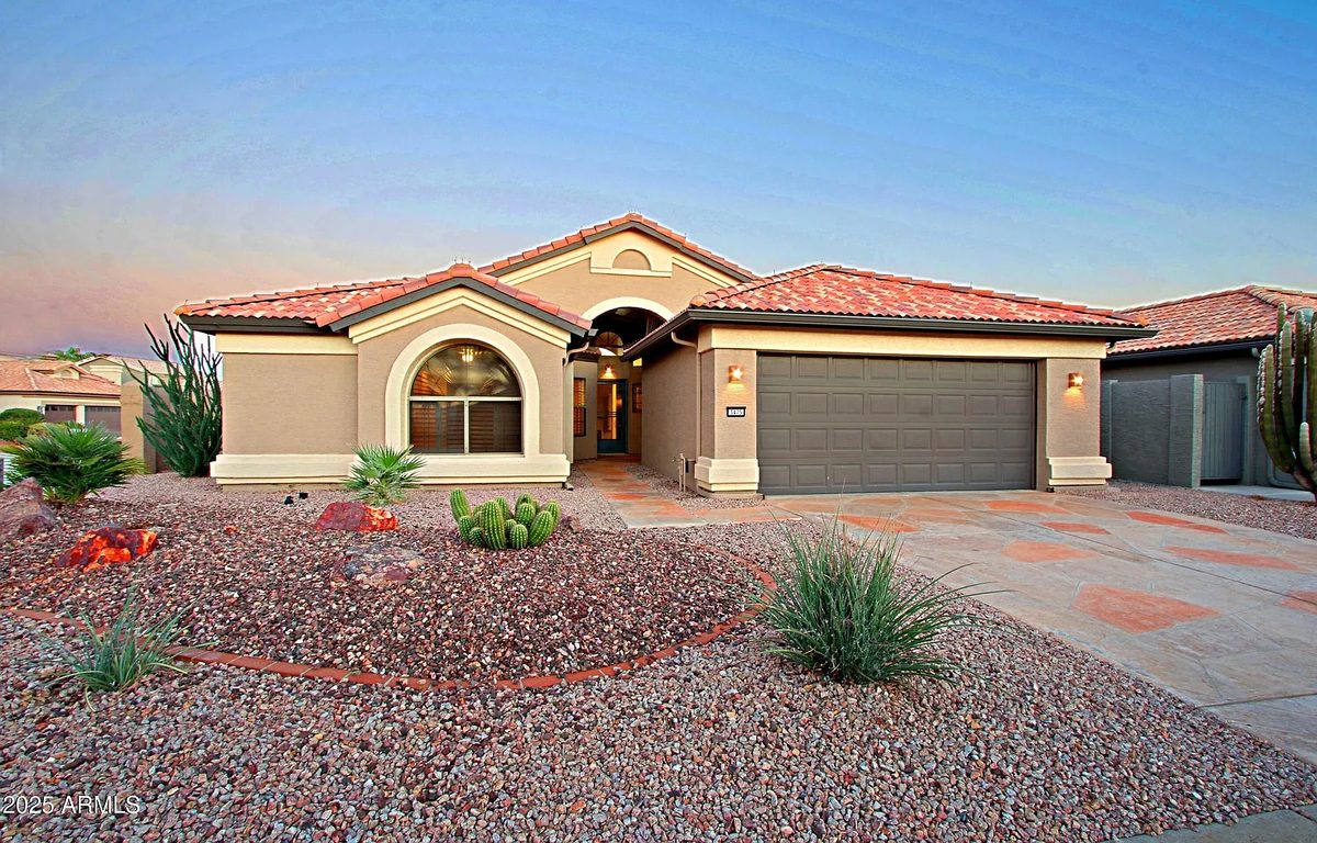
Mailed the new owner a hand-written letter.
Letter #3 of 4Dropped 2 homes that listed on the MLS. No wasted postage.
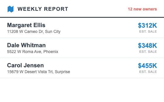
Your weekly report: 12 new owners, ranked, with case numbers, and 1 reply waiting.
What we do
Your sales agent runs 24/7
From reading the county record to a letter in the owner's mailbox, your agent handles it all automatically.
1/4 · Finds
Finds likely sellers before anyone else
Your agent reads every recorded deed, probate and divorce docket, the tax roll, and building permits nightly, and matches each signal to a single unsold home.
2/4 · Filters
Scores every owner & keeps only the best
Your agent scores every signal against the county's own sales record, ranks owners by how likely they are to sell, and drops the ones the data says will stay, before a single stamp is spent.
3/4 · Contacts
Reaches owners before the MLS knows
Your agent drafts and mails hand-written letters under your name and license, timed to the filing, not to a drip schedule, and replies land straight in your inbox.
Tuesday, August 25
9:41
Got your letter about my mother's house. Are you free to talk this week?
Re: 5522 W Roma Ave Thanks for the note, what could it list for?
4/4 · Learns
Gets sharper with every closing
Your agent was backtested on 48,431 closed Maricopa sales, and every new closing feeds back into the weights, county by county, week by week.
The numbers
We backtested our AI signals
on a year of Maricopa sales. All 48,431 of them.*
Every classic lead play, scored on the same sales, Aug 2025 to
Aug 2026.
44% of the owners our agent flagged sold within a year:
double the best classic play.
*Every priced single-family, single-parcel sale recorded by county affidavit, Aug 15, 2025 to Aug 15, 2026. Sales under $50k and affidavit-exempt transfers (such as foreclosure trustee deeds) are not counted.
Past performance
Past performance
Our September 2025 list flagged 45 homes. 11 months later, 20 have sold, with a median 4 months from flag to closing.
| Flagged | Property | Today | Flag → sold |
|---|---|---|---|
| Sep 2 | 3475 N 149th Ave, Goodyear | Sold Dec 17, 2025, $435,000 | 3 mo |
| Sep 2 | 6815 N 32nd Ave, Phoenix | Sold Jun 9, 2026, $360,000 | 9 mo |
| Sep 3 | 2111 E Marlene Dr, Gilbert | Sold (per Zillow, $922,097) | ~11 mo |
| Sep 3 | 26437 W Ross Ave, Buckeye | Still in the estate | – |
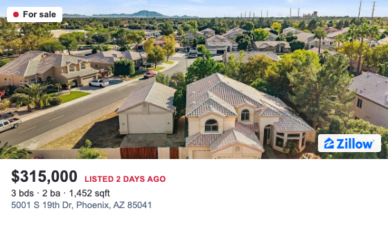
| Sep 3 | 5001 S 19th Dr, Phoenix | For sale now, $315,000 | listed |
| Sep 4 | 4940 E Justica St, Cave Creek | Sold Jun 15, 2026, $630,000 | 9 mo |
| Sep 5 | 10426 W Cinnebar Ave, Sun City | Sold Jan 29, 2026, $192,000 | 4 mo |
| Sep 5 | 10758 W Carlota Ln, Peoria | Still in the estate | – |
| Sep 5 | 17283 W Valentine St, Surprise | Still in the estate | – |
| Sep 5 | 262 W Tulsa St, Chandler | Still in the estate | – |
| Sep 5 | 3813 W Cochise Dr, Phoenix | Pre-foreclosure | – |
| Sep 8 | 1511 S 84th Dr, Tolleson | Still in the estate | – |
| Sep 8 | 1825 E Weldon Ave, Phoenix | Still in the estate | – |
| Sep 9 | 12424 W Cambridge Ave, Avondale | Still in the estate | – |
| Sep 9 | 1325 W Willetta St, Phoenix | Sold Nov 4, 2025, $392,000 | 1 mo |
| Sep 9 | 22491 E Avenida Del Valle, Queen Creek | Sold Dec 4, 2025, $500,000 | 2 mo |
| Sep 9 | 509 W Baseline Rd, Buckeye | Still in the estate | – |
| Sep 9 | 741 E Yale Dr, Tempe | Still in the estate | – |
| Sep 9 | 9604 W Purdue Ave, Peoria | Sold Dec 18, 2025, $328,000 | 3 mo |
| Sep 10 | 16155 N 87th Dr, Peoria | Sold May 21, 2026, $551,750 | 8 mo |
| Sep 10 | 7814 W Hollyhock Dr, Phoenix | Still in the estate | – |
| Sep 11 | 4401 W Dunbar Dr, Laveen | Sold Jan 21, 2026, $449,900 | 4 mo |
| Sep 11 | 6715 E Butte St, Mesa | Sold Dec 5, 2025, $295,000 | 2 mo |
| Sep 12 | 11627 W Hackbarth Dr, Youngtown | Sold Feb 26, 2026, $381,000 | 5 mo |
| Sep 12 | 4835 E Dartmouth Cir, Mesa | Still in the estate | – |
| Sep 12 | 6144 W Marconi Ave, Glendale | Still in the estate | – |
| Sep 15 | 10645 W Sequoia Dr, Sun City | Sold Sep 24, 2025, $283,300 | 0 mo |
| Sep 15 | 1313 N 65th St, Mesa | Still in the estate | – |
| Sep 15 | 18387 N Summerbreeze Way, Surprise | Still in the estate | – |
| Sep 15 | 3032 W Windrose Dr, Phoenix | Sold Oct 23, 2025, $320,000 | 1 mo |
| Sep 15 | 4460 E Carob Dr, Gilbert | Sold (per Zillow, $550,000) | ~11 mo |
| Sep 15 | 7035 N 25th Dr, Phoenix | Still in the estate | – |
| Sep 16 | 11816 W Bloomfield Rd, El Mirage | Sold Feb 13, 2026, $275,000 | 5 mo |
| Sep 16 | 21843 E Puesta Del Sol, Queen Creek | Still in the estate | – |
| Sep 16 | 340 S Olive, Mesa | Still in the estate | – |
| Sep 17 | 3302 E Taro Ln, Phoenix | Sold Nov 3, 2025, $300,000 | 1 mo |
| Sep 17 | 4608 W Bethany Home Rd, Glendale | Still in the estate | – |
| Sep 17 | 7646 E Dover St, Mesa | Still in the estate | – |
| Sep 17 | 9809 N 67th Dr, Peoria | Sold Jun 17, 2026, $269,718 | 9 mo |
| Sep 18 | 3102 N 145th Ln, Goodyear | Still in the estate | – |
| Sep 18 | 4257 E Michelle Ave, Gilbert | Sold Mar 24, 2026, $518,000 | 6 mo |
| Sep 18 | 951 E Inca St, Mesa | Still in the estate | – |
| Sep 19 | 23320 N 90th Dr, Peoria | Still in the estate | – |
| Sep 19 | 2379 W Whisper Rock Trl, Phoenix | Sold May 7, 2026, $498,000 | 7 mo |
| Sep 19 | 720 E Tonto Dr, Chandler | Still in the estate | – |
Pricing
Motivated owners found. Campaign launched.
All in 10 minutes.
One won listing a year pays for itself nine times over.
Pro
$99 /month
- AI agent prospecting 24/7
- Unlimited intent signals
- Single agent account
- Up to 1,000 prospects per month
- All prospects with email, address, phone number
- Unlimited email sends
- $2 / handwritten note
- $1 / printed note
Custom
Talk with us
For teams of 3+ splitting counties, and investors running acquisition at volume.
- Everything in Pro
- Custom number of AI agents prospecting 24/7
- Custom number of prospects contacted per month
- Deep & custom integrations
- Admin access & view
- Dedicated customer success manager